This winter season has little time left, but it is certain that it will be remembered in much of the Northern Hemisphere as the winter that has not just arrived.
The temperature records in weather stations in Europe and the United States, for example, show average values above 2 or 3 degrees Celsius in the last three months.

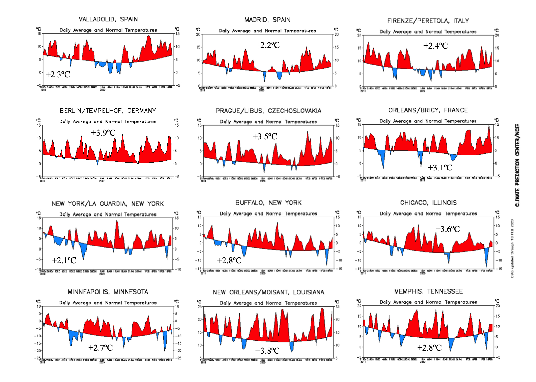
Time series of the average daily temperature between November 20, 2019 and February 18, 2020, and its deviation from the 1981-2010 weather average. Peak values in blue, indicate cold days, which have been scarce.
Thus, the 2019-2020 winter season is anomalously warm. For example, for the last three months, in southern Europe, communities such as Madrid, Valladolid, or Florence show anomalies above 2.2ºC. Central and Eastern Europe have values above 3.0ºC. For example, Berlin shows anomalies of 3.9ºC, Prague 3.5ºC and Orleans, 3.1ºC. On the other side of the Atlantic, in the United States, cities such as New York, Buffalo, Memphis or Minneapolis, present anomalies greater than 2ºC, with a record record reaching almost 4ºC of anomaly the city of New Orleans and Chicago in the center of that country.

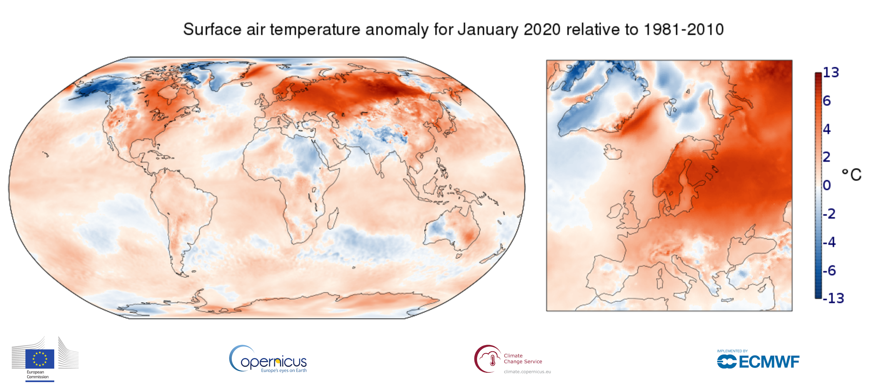
Surface air temperature anomaly for January 2020 relative to the January average for the period 1981-2010. Data source: ERA5. Credit: Copernicus Climate Change Service/ECMWF
Last January, which is expected to be the coldest month for the winter, temperatures have been abnormally warm in almost the entire Northern Hemisphere. Europe has recorded on average the warmest January of its historical record. The winter absent in January has practically made itself felt in much of the United States (except Alaska), Russia, and most of the rest of Asia, with anomalies of up to 6-7°C.
Another absent queen this winter has been snow, not only because the temperatures are exceptionally high but also because the rains have been notoriously low. Numerical climate models seem to indicate that this tendency to abnormally high thermal values will prevail at least until the beginning of the summer.